Bangalore Metro Red Line — Phase 3A, Sarjapur to Hebbal
Namma Metro Red Line (Phase 3A) is a 36.59 km corridor connecting Sarjapur in south-east Bengaluru to Hebbal in the north. The line has 28 stations — 17 elevated and 11 underground — passing through Koramangala, NIMHANS, Dairy Circle, Town Hall, and Mekhri Circle. The Karnataka Cabinet approved the project on December 6, 2024, at a revised cost of ₹25,485 crore. Geotechnical surveys began in January 2026 — the first on-ground activity on the corridor. Updated June 2026.
Karnataka Cabinet approved Phase 3A on December 6, 2024, at ₹25,485 crore. The revised DPR has been submitted to the Union Government for central approval. Geotechnical surveys (soil testing) started in January 2026. Full construction will begin after Union Cabinet approval, targeting operations by December 2030.
Red Line Phase 3A — Quick Facts
- Route: Sarjapur to Hebbal (south-east to north)
- Stations: 28 (17 elevated + 11 underground) • Total length: 36.59 km
- Cost: ₹25,485 crore (revised from ₹28,405 crore)
- Karnataka Cabinet approval: December 6, 2024
- Union Cabinet approval: Awaited (pending as of mid-2026)
- Geotechnical surveys: Started January 2026
- Target opening: December 2030
- Interchanges: 5 stations (Blue Line ×3, Pink Line, Purple Line)
- Key areas served: Koramangala, Bellandur, NIMHANS, Dairy Circle, Town Hall, Mekhri Circle
Red Line at a Glance
| Total length | 36.59 km (22.14 km elevated + 14.45 km underground) |
| Number of stations | 28 (17 elevated + 11 underground) |
| Revised project cost | ₹25,485 crore (original DPR: ₹28,405 crore) |
| Cost per km | ~₹688 crore/km (revised) |
| Karnataka Cabinet approval | December 6, 2024 |
| Union Cabinet approval | Awaited (revised DPR submitted) |
| Geotechnical surveys | Started January 2026 (₹6.86 crore tender) |
| Target opening | December 2030 |
| Interchange stations | 5 (Blue Line ×3, Pink Line, Purple Line) |
| Operator | BMRCL (Namma Metro) |
| DPR consultant | SYSTRA (French consultancy, cost optimisation) |
Red Line — All 28 Stations (Sarjapur to Hebbal)
The Red Line runs 36.59 km from Sarjapur in south-east Bengaluru to Hebbal in the north. Stations 1–9 are elevated (outer south-east corridor); stations 10–22 are a mix of elevated and underground through the dense core (Bellandur, Koramangala, NIMHANS, Dairy Circle, Town Hall); stations 23–28 continue north to Hebbal. The precise elevated/underground split per station will be confirmed once the DPR is finalised with the Union Government.
| # | Station | Notes |
|---|---|---|
| 1 | Sarjapur | Southern terminus. Sarjapur IT corridor. |
| 2 | Kada Agrahara Road | Sarjapur Road area. |
| 3 | Sompura | Sarjapur Road corridor. |
| 4 | Dommasandra | Growing residential zone, Sarjapur Road. |
| 5 | Muthanallur Cross | Carmelaram–Sarjapur zone. |
| 6 | Kodathi Circle | Near Kodathi village, outer ORR. |
| 7 | Ambedkar Nagar | South-east Bengaluru. |
| 8 | Carmelaram | Near Carmelaram railway station. |
| 9 | Doddakanalli | Outer Ring Road area. |
| 10 | Kaikondrahalli | Sarjapur Outer Ring Road junction. |
| 11 | Bellandur Gate | Bellandur tech corridor. |
| 12 | Ibbalur | Interchange — Blue Line. Near Marathahalli–ORR junction. |
| 13 | Agara | Interchange — Blue Line. Near Silk Board flyover, HSR Layout. |
| 14 | Jakkasandra | HSR Layout, south Bengaluru. |
| 15 | Koramangala 3rd Block | South Koramangala. Start of underground section. |
| 16 | Koramangala 2nd Block | Central Koramangala, dense urban core. |
| 17 | Dairy Circle | Interchange — Pink Line. Major hub near Bannerghatta Road. |
| 18 | NIMHANS | National Institute of Mental Health and Neurosciences. Underground. |
| 19 | Shantinagara | Central Bengaluru. Underground. |
| 20 | Town Hall | Central business district. Underground. |
| 21 | KR Circle | Interchange — Purple Line. Major city centre hub. Underground. |
| 22 | Basaveshwara Circle | North of KR Circle. Underground. |
| 23 | Bengaluru Golf Course | Raj Bhavan Road area. |
| 24 | Palace Guttahalli | Near Malleswaram–Sadashivanagar. |
| 25 | Mekhri Circle | Near Bellary Road flyover junction. |
| 26 | Veterinary College | Dropped in revised DPR (2025) to reduce costs. BJP MPs opposed removal. Status TBD pending GoI approval. |
| 27 | Ganga Nagar | North Bengaluru, near Hebbal flyover. |
| 28 | Hebbal | Northern terminus. Interchange — Blue Line. Interchange — Orange Line (Phase 3). |
Station names are as per the DPR submitted by BMRCL to the Karnataka government. The original DPR listed 28 stations; the revised DPR (₹25,485 crore) dropped Veterinary College station, reducing the count to 27. The final station list will be confirmed once the Union Cabinet approves the project. Station names may also be renamed after branding decisions.
Interchange Stations
The Red Line has five interchange stations, connecting it to the Purple, Pink, and Blue Lines, as well as to Phase 3's Orange Line at Hebbal:
| Station | Connects with | Significance |
|---|---|---|
| Ibbalur | Blue Line | ORR tech corridor; connects to Central Silk Board and KIA Airport. |
| Agara | Blue Line | Near HSR Layout; secondary Blue Line interchange. |
| Dairy Circle | Pink Line | Bannerghatta Road; access to Pink Line's underground section. |
| KR Circle | Purple Line | City centre; transfer to Majestic, MG Road, Whitefield, Kengeri. |
| Hebbal | Blue Line + Orange Line (Phase 3) | Northern hub; three-line interchange linking Airport Metro and Phase 3 ORR corridor. |
Red Line Timeline
✓ Inception — Comprehensive Mobility Plan 2020
The Sarjapur–Hebbal corridor was first proposed in Bengaluru's Comprehensive Mobility Plan 2020 as a priority corridor linking the fast-growing south-east IT zone to the rest of the city.
✓ Karnataka Cabinet Approval — December 6, 2024
Karnataka Cabinet gave formal approval to Phase 3A on December 6, 2024. The initial DPR estimated the project at ₹28,405 crore. The file was then sent to the Union Government for central approval (Union Cabinet holds 50% equity in Namma Metro).
✓ Cost Optimisation — 2025
The Union Government requested cost rationalisation. French consultancy SYSTRA reviewed the DPR and reduced the cost to ₹25,485 crore — a saving of ₹2,920 crore — by reducing underground station lengths by 40 metres without changing the route or station count. Cost per km dropped from ₹767 crore to ₹688 crore.
✓ Geotechnical Survey Tenders — Late 2025
BMRCL floated geotechnical survey tenders worth ₹6.86 crore for the Red Line corridor. The selected contractor was given 150 days to complete soil testing.
✓ Geotechnical Surveys Begin — January 2026
Soil testing along the Sarjapur Road corridor started in January 2026 — the first physical on-ground activity on the Red Line. Surveys will inform tunnel design and foundation engineering for the underground sections.
⏳ Union Cabinet Approval — Pending (expected 2026)
The revised DPR (₹25,485 crore) has been submitted to the central government. Central approval was expected by March 2026; it remains pending as of mid-2026. Once approved, BMRCL will invite civil construction tenders.
🎯 Target Opening — December 2030
The Red Line is targeted to become operational by December 2030, pending timely central approval and construction commencement. The underground sections through Koramangala and the city centre will be the most complex to build.
What the Red Line Means for Bengaluru
- Sarjapur Road finally on the metro map — One of Bengaluru's fastest-growing IT corridors (home to major campuses of Wipro, Infosys, and hundreds of startups), Sarjapur Road has never had metro connectivity. The Red Line fills this critical gap.
- Koramangala and HSR Layout underground — The 11 underground stations through Koramangala, NIMHANS, Dairy Circle, and Town Hall serve the city's most densely built-up areas where elevated infrastructure would not be feasible.
- City-centre connectivity — Stations at Town Hall and KR Circle bring metro access deep into the commercial core, with a transfer to the Purple Line for MG Road, Majestic, and Whitefield.
- Five interchange points — The Red Line ties into the Purple, Pink, Blue, and Orange Lines, making it a key connector in the future 220 km+ network.
- Airport access via interchange — Passengers from Sarjapur Road can transfer at Ibbalur or Agara to the Blue Line and reach Kempegowda International Airport without a single road journey.
Red Line — Frequently Asked Questions
What is the Bangalore Metro Red Line (Phase 3A)?
The Red Line is Phase 3A of Namma Metro — a 36.59 km corridor with 28 stations connecting Sarjapur in south-east Bengaluru to Hebbal in the north. It has 17 elevated stations and 11 underground stations. Karnataka Cabinet approved the project on December 6, 2024, at ₹25,485 crore (revised cost). Union Cabinet approval is pending.
When will the Red Line open?
The Red Line is targeting operations by December 2030. Karnataka Cabinet approved the project in December 2024. Geotechnical surveys began January 2026. Full construction will start once the Union Cabinet gives central approval — which was expected by end-2026 at the time of the revised DPR submission.
How many stations does the Red Line have?
The Red Line has 28 stations — 17 elevated stations over 22.14 km and 11 underground stations over 14.45 km. Key stations include Carmelaram, Bellandur Gate, Ibbalur, Koramangala, Dairy Circle, NIMHANS, Town Hall, KR Circle, Mekhri Circle, Veterinary College, and Hebbal.
Which metro lines will the Red Line connect with?
The Red Line has 5 interchange stations: Ibbalur and Agara (both Blue Line), Dairy Circle (Pink Line), KR Circle (Purple Line), and Hebbal (Blue Line + Orange Line). The Hebbal terminus will be a three-line hub connecting Airport Metro and the Phase 3 western ORR corridor.
How much does the Red Line cost?
The revised project cost is ₹25,485 crore — reduced from the originally submitted ₹28,405 crore. The Union Government requested cost optimisation; SYSTRA reviewed the DPR and cut costs by ₹2,920 crore by reducing the length of underground stations by 40 metres, keeping the route and station count unchanged.
What is the current construction status of the Red Line?
As of mid-2026, the Red Line is in the pre-construction phase. Karnataka Cabinet approved the project in December 2024. The revised DPR (₹25,485 crore) has been submitted to the Union Government. BMRCL floated geotechnical survey tenders (₹6.86 crore) and soil testing started in January 2026 — the first on-ground activity on the corridor. Civil construction tenders will follow once Union Cabinet approval is granted.
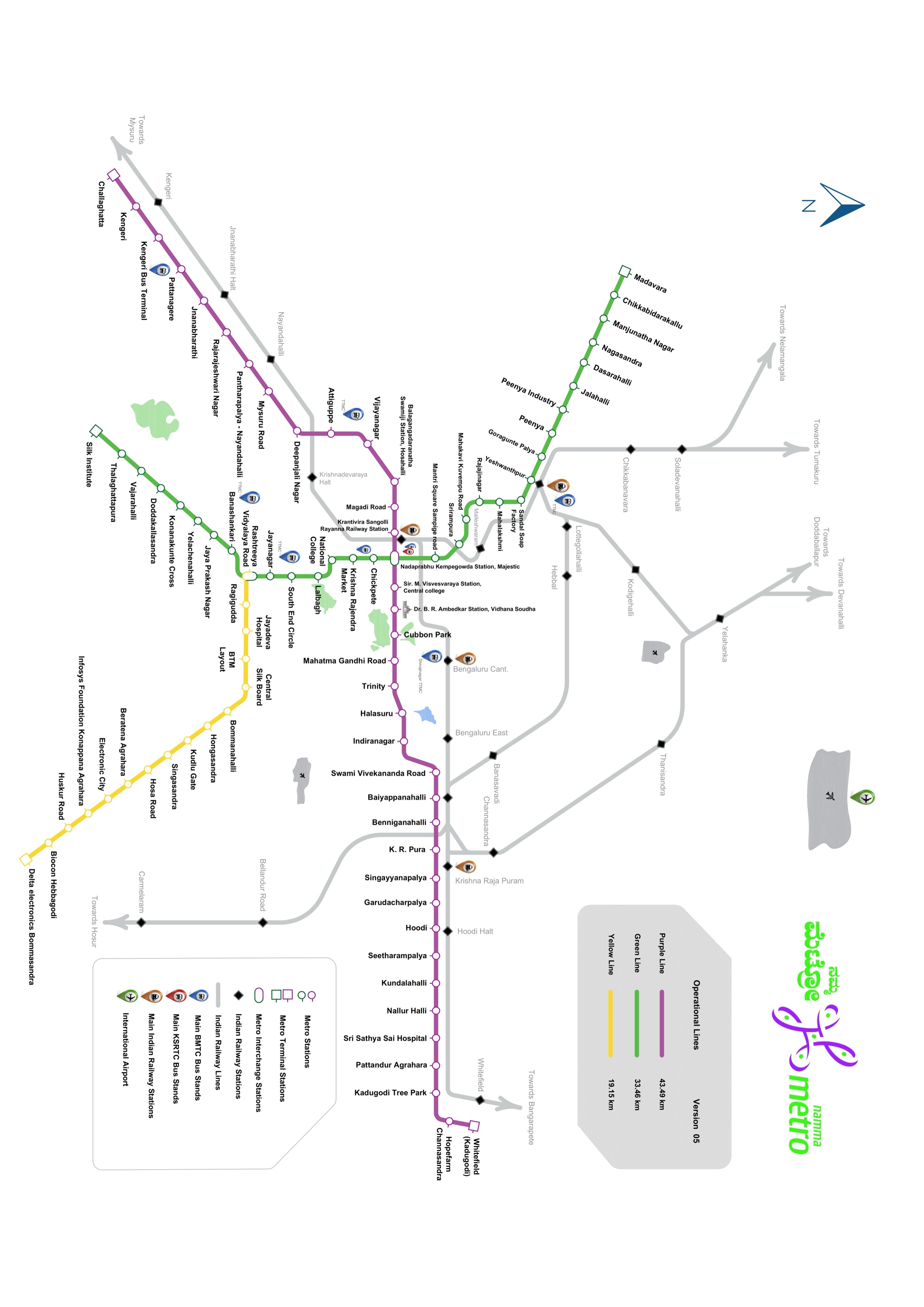
Red Line on the Metro Map
See where the Red Line fits in the full Namma Metro network.
Sources
- OneIndia — Karnataka Cabinet approves Phase 3A (Dec 2024)
- Rail Analysis India — Phase 3A Karnataka Cabinet approval, ₹28,405 crore
- Deccan Herald — Centre seeks cost cut in ₹28,405 crore estimate
- Deccan Herald — Metro trims costs, shortens stations (₹25,485 crore revised)
- OneIndia — DPR revised, ₹2,920 crore cost reduction
- Wikipedia — Red Line (Namma Metro)